Reference data set from Arrenæs
A 2D/3D data set of recorded travel time data from a cross hole Georadar experiment is available in the 'data/crosshole' folder.
4 Boreholes were drilled, AM1, AM2, AM3, and AM4 at the locations shown below
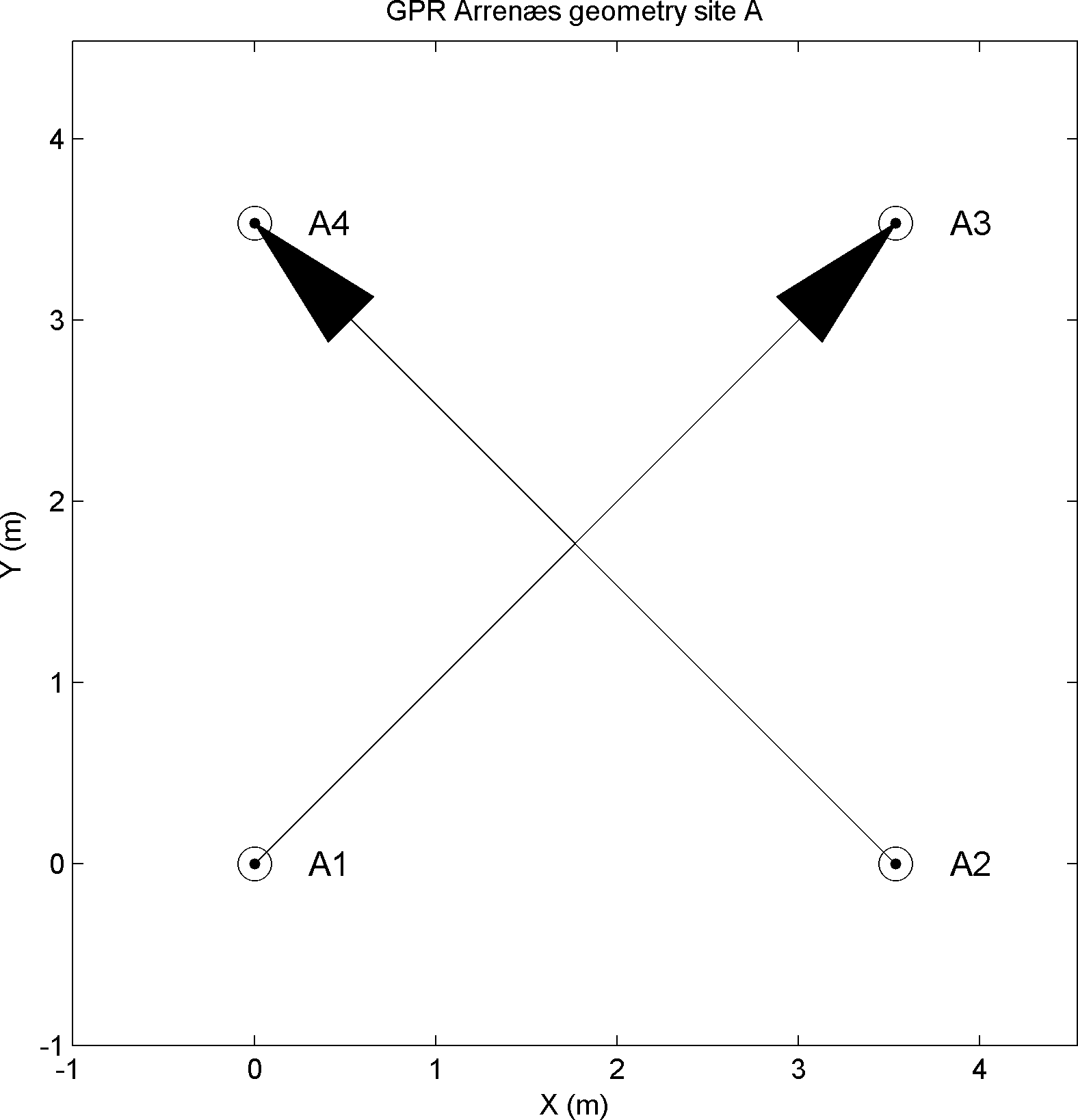
Travel time data were collected between boreholes AM1 and AM3, and AM2 and AM4 respectively, in a depth interval between 1m and 12m. The travel times for each of the two 2D data sets are available in the AM13_data.mat and AM24_data.mat files. All the data have been combined in the 3D data set available in AM1234_data.mat.
All mat-files contains the following variable
S --> [ndata,ndim] each row contains the position of the source
R --> [ndata,ndim] each row contains the position of the receiver
d_obs --> [ndata,1] each row contains the observed travel time in milliseconds
d_std --> [ndata,1] each row contains the standard deviation of the uncertainty of the observed travel time in milliseconds
All data are also available as ASCII formatted EAS files in AM13_data.eas, AM24_data.eas, and AM1234_data.eas.
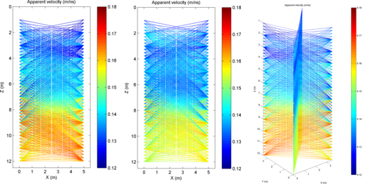
The following 3 Figures show the ray coverage (using straight rays) for each of the AM13, AM24, and AM1234 data sets. The color of each ray indicates the average velocity along the ray computed using v_av = raylength/d_obs. AM13 ray coverageAM24 ray coverageAM1234 ray coverage.